
| Date | Name of Vessel |
Type of Vessel |
Tonnage JANAC |
Tonnage Alden |
Location | Assessment JANAC |
Assessment Alden |
|---|---|---|---|---|---|---|---|
| none | |||||||
Award of Submarine Combat Insignia for this patrol is NOT authorized.
(A) Prologue
(B) Narrative
(C) Weather
(D) Tidal Information
(E) Navigational Aids
(F) Ship Contacts
(G) Aircraft Contacts
(H) Attack Data
(I) Mines
(J) Anti-Submarine Measures and Evasion Tactics
(K) Major Defects and Damage
(L) Radio
(M) Radar
(N) Sound Gear and Sound Conditions
(O) Density Layers
(P) Health, Food, and Habitability
(Q) Personnel
(R) Miles Steamed - Fuel Used
(S) Duration
(T) Factors of Endurance Remaining
(U) Radio and Radar Countermeasures
(V) Remarks
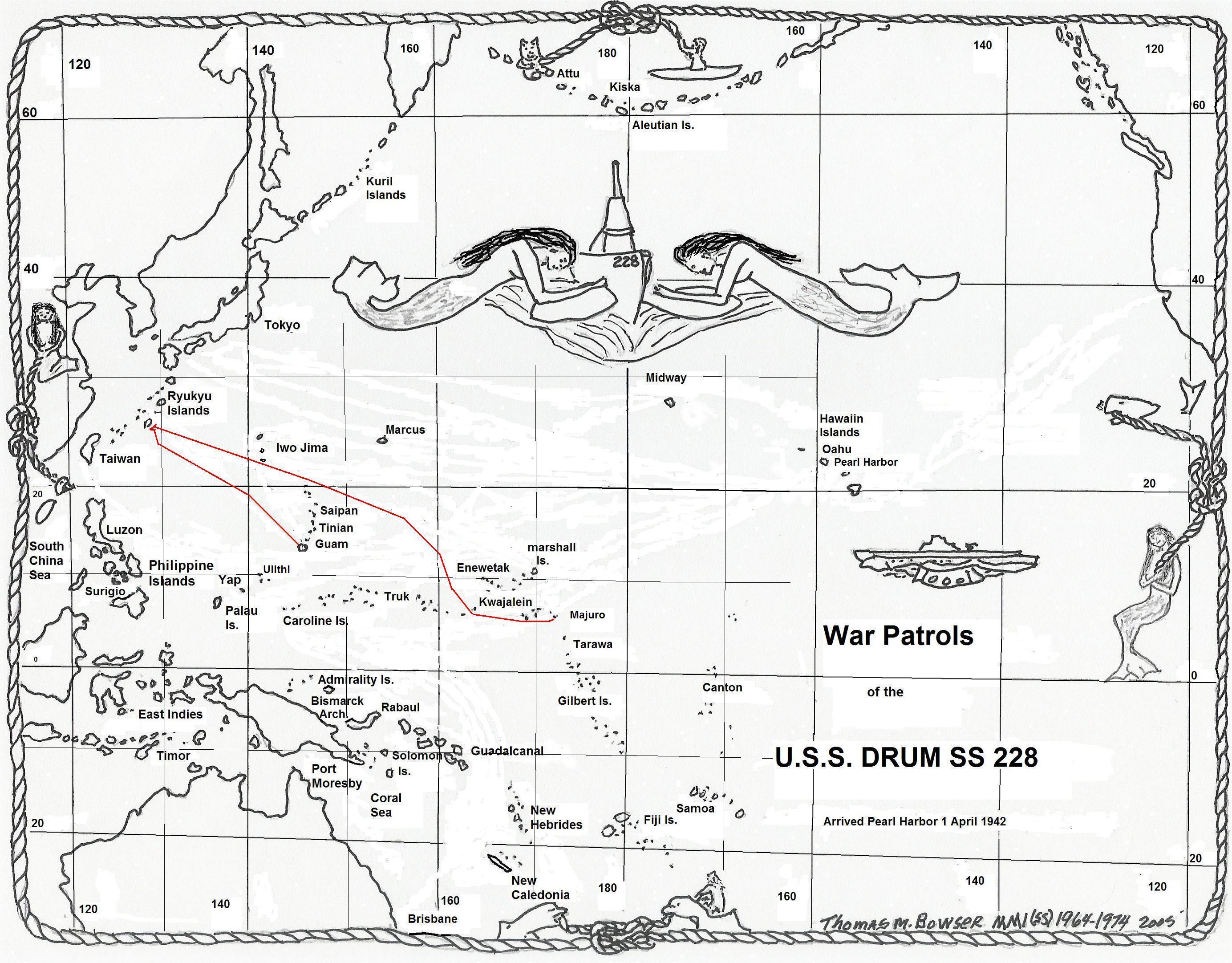
Arrived Majuro, Marshall Islands from eleventh war patrol on November 8, 1944. Normal refit accomplished by U.S.S. HOWARD W. GILMORE (AS 16) and Submarine Division 222. Drydocked twice to eliminate excessive cavitation noises from the port shaft. Port screw was replaced during the second docking.
On November 15, 1944, Lieutenant Commander M.H. Rindskopf, USN, was relieved as Commanding Officer by Lieutenant Commander F.M. Eddy, USN. Lieutenant (jg) T. Hazapis, USNR, was detached and Lieutenant M.R. Etheridge, USN, reported aboard for duty.
Seven days were spent in training during which two Mark 18 exercise torpedoes and four Mark 23 exercise torpedoes were fired.
Readiness for sea December 7, 1944.
| 7 December | |
| 0700 (M) | Departed Majuro, Marshall Islands in accordance with ComSubPac Operation Order No. 402-44 for twelfth war patrol in company with U.S.S. RAMSAY (DM 16), the escort. |
| 1045 | Sighted U.S.S. SARGO (SS-188) enroute Majuro. |
| 1100 | Parted company with RAMSAY; entered safety lane. |
| 8 December - 17 December | |
| Enroute area, conducting daily training dives and fire control drills. | |
| 13 December | |
| 1200 (K) | Changed course to north to change routing to area in accordance with ComSubPac dispatch 130008. |
| 15 December | |
| 1230 (K) | SD contact, range 8 miles closing to 6. (Aircraft Contact No. 1). Dove. |
| 1305 | Surfaced. |
| 1405 | SD contact, range 14 miles, with I.F.F. (Aircraft Contact No. 2). Contact lost at 23 miles. |
| 1516 | SD contact, range 20 miles, with I.F.F. (Aircraft Contact No. 3). Two targets lost at 22 miles. |
| 1642 | Sighted 3 Liberators, range 10 miles. (Aircraft Contact No. 4). |
| 2330 | Made SJ radar contact on Minami Iwo Jima Island bearing 010°(T), distant 45 miles. |
| 17 December | |
| 2318 (I) | Made SJ radar contact on Minami Daito Jima Island bearing 282°(T), distant 17 miles. |
| 18 December | |
| 0550 (I) | Dove with Minami Daito Jima bearing 046°(T), distant 12 miles. |
| 0928 | Sighted Sally, range 8 miles over the island. (Aircraft Contact No. 5). |
| 1055 | Sighted small tug towing barge near the island. (Ship Contact No. 1). |
| 1826 | Surfaced; set course for Okinoyerabu Jima. |
| 19 December | |
| 0226 (I) | Made SJ radar contact on Okinoyerabu Jima, bearing 310°(T), distant 30 miles. |
| 0615 | Dove with Yoron Jima bearing 280°(T), distant 16 miles. |
| 1030 | Sighted 10 unidentified planes, range 10 miles, over Okinoyerabu Jima heading north. (Aircraft Contact No. 6). |
| 1823 | Surfaced. Set course to pass between Yoron Jima and Okinoyerabu Jima. |
| 2024 | Made SJ radar contact bearing 072°(T), range 8700 yards. (Ship Contact No. 2). Target is very small and can only be seen intermittently. Assumed to be a small patrol boat or fisherman. |
| 20 December | |
| 0410 (I) | Made SJ radar contact on Aguni Shima, bearing 205°(T), distant 17 miles. Intend to dive between Aguni Shima and Zampa Misaki to get an estimate of the anti-submarine activities in this area. |
| 0618 | Dove 18 miles from Zampa Misaki having encountered no patrol boats or planes and having had no indications of enemy shore-based radar. |
| 1214 | Sighted 10 unidentified planes, range 10 miles, over Okinawa Jima. (Aircraft Contact No. 7). |
| 1246 | Sighted 3 unidentified planes, range 10 miles, over Okinawa Jima. (Aircraft Contact No. 8). |
| 1318 | Sighted 1 unidentified plane, range 10 miles, over Okinawa Jima. (Aircraft Contact No. 9). |
| 1840 | Surfaced 9 miles east of Aguni Shima, with no indications of enemy radar. Set course to enter new area at midnight. |
| 21 December | |
| 0640 (I) | Dove 55 miles west of Tori (Iwo) Shima. |
| 1640 | Sighted Tori (Iwo) Shima bearing 084°(T), distant 25 miles. |
| 1827 | Surfaced. Commenced patrol to westward. |
| 22 December | |
| 0345 (I) | Made SJ radar contact on Tokuna Shima bearing 116°(T), distant 32 miles. |
| 0615 | Dove 10 miles east of Tori (Iwo) Shima. |
| 1523 | Sighted sampan bearing 014°(T), range 3 miles, enroute from Tori (Iwo) Shima to Tokuno Shima. (Ship Contact No. 3). |
| 1830 | Surfaced. Commenced patrol to westward. |
| 23 December | |
| 0645 (I) | Dove near western boundary of area. |
| 1830 | Surfaced. |
| 24 December | |
| 0630 (I) | Dove near western boundary of area. |
| 1830 | Surfaced. |
| 25 December | |
| 0610 (I) | Dove 23 miles east of Tori (Iwo) Shima, closing Kakeroma Shima. |
| 0844 | Sighted unidentified plane, range 8 miles. (Aircraft Contact No. 10). |
| 1404 | Sighted Betty, range 12 miles. (Aircraft Contact No. 11). |
| 1835 | Surfaced 20 miles west of Sotsuko Zaki; set course to enter new area at midnight. |
| 26 December | |
| 0630 (I) | Dove in western part of area. |
| 1830 | Surfaced. Commenced patrol to south. |
| 2200 | Commenced patrol to east and west of convoy reported by China based plane. |
| 27 December | |
| 0645 (I) | Dove. |
| 1456 | Sighted Yokoate Shima bearing 138°(T), distant 40 miles. |
| 1826 | Surfaced. |
| 28 December | |
| 0435 (I) | Contact on APR at 150 mc. Had indications of enemy radar sweeping until diving. |
| 0610 | Dove 12 miles southeast of Yokoate Shima. |
| 0630 | Heard pinging bearing 150°(T). (Ship Contact No. 4). |
| 0640 | Sighted two ships, range about 3 miles. Visibility is still poor (sunrise is at 0716) and it is not possible to identify them. The nearer appears to be a patrol vessel and the other could be a small Maru. |
| 0655 | With improved visibility both ships appear to be patrol vessels, the nearer a trawler type. |
| 0658 | The trawler suddenly turns toward at a range of 2000 yards. With every indication that we had been detected, went deep and commenced evasive tactics. |
| 0705 | Pinging has ceased as both patrol boats listen (the trawler alone has been pinging). |
| 0730 | Trawler again is pinging and the range to both has increased. |
| 0805 | Pinging no longer heard. |
| 0810 | At periscope depth, nothing but land in sight. |
| 0940 | Sighted one unidentified plane, range 8 miles. (Aircraft Contact No. 12). |
| 1000 | Sighted Emily, range 6 miles. (Aircraft Contact No. 13). |
| 1045 | Sighted five unidentified planes, range 6 miles. (Aircraft Contact No. 14). |
| 1830 | Surfaced. |
| 29 December | |
| 0405 (I) | Made SJ radar contact on Takara Jima, bearing 113°(T), distant 24 miles. |
| 0505 | Contact on APR at 157 mc. Had indications of enemy radar sweeping until diving. |
| 0630 | Dove. |
| 0700 | Sighted Akuseki Jima bearing 093°(T), distant 38 miles and Takara Jima bearing 145°(T), distant 29 miles. |
| 1010 | Sighted Betty, range 8 miles. (Aircraft Contact No. 15). |
| 1630 | Sighted Rufe, range 5 miles. (Aircraft Contact No. 16). |
| 1830 | Surfaced. No indications of enemy radar. |
| 30 December | |
| 0635 (I) | Dove 30 miles west of Gaja Shima. |
| 1038 | Sighted unidentified plane, range 15 miles. (Aircraft Contact No. 17). |
| 1045 | Sighted unidentified plane, range 10 miles. (Aircraft Contact No. 18). |
| 1046 | Possible screw contact on JP, bearing 173°(T). |
| 1058 | Sighted Pete, range 8 miles, circling. (Aircraft Contact No. 19). Heard pinging bearing 175°(T). (Ship Contact No. 5). |
| 1100 | Sighted smoke bearing 180°(T). |
| 1115 | Manned battle stations, commenced attack. (Torpedo Attack No. 1). It looks as though we are right on the track of this convoy. The true bearing has been nearly constant for almost fifteen minutes. Sighted masts of 5 freighters and 3 escorts disposed as follows: 2 loose columns, 2 ships in far column, 3 in near column. One DE escort on the starboard bow, trawler on the port bow, and another DE on the port beam of the formation. Angles on the bow are all near zero. Ships are 4 MFM medium freighters and 1 KFK medium freighter. |
| 1142 | With the range to the leading ship 7000 yards, convoy zigged 45° to the right. Came left for an approximate 45° port track. Picked the last ship in the near column, which appeared to be the largest, (? MFM-AK) as our target. |
| 1202 | Set up is checking nicely, range 1900 yards, angle on the bow 70° port. At this time the 2 leading ships in the near column were closely overlapped by the 2 ships in the far column. Shifted targets, deciding to fire bow tubes at the consolidated target, and swing for stern tube shot at original target. New target set up was as follows: range to nearest 2000 yards, angle on the bow 90° port, 90° port track, target length estimated at 1000 feet. |
| 1203 | Commenced firing six torpedoes from the bow tubes at the middle AK, range 2000 yards, spread to cover 1000 feet. |
| 1205 | Commenced swinging right to fire stern tubes at our original target. The trawler was between us and the target and uncomfortably close. |
| 1209 | With the trawler showing us a small port angle on the bow at a range of about 500 yards, decided we were not in a healthy position. Gave up the stern tube shot, went deep and commenced evasive tactics. |
| 1210 | Heard first of six depth charges, none closer than 200 yards. No damage. Heard no torpedo explosions. I don't believe the escorts ever had a good sound-contact, and as there were no torpedo tracks to follow, they never knew where we were. However, it is inconceivable that the trawler could no locate us as we presented our beam to him at periscope depth at very close range. One escort passed directly over us but dropped nothing. |
| 1330 | Can only hear pinging now, no screws. |
| 1430 | All clear on sound, up for a look, all clear. |
| 1555 | Heard pinging bearing 092°(T) as a snooper arrived on the scene from one of the nearby islands. |
| 1615 | Sighted two planes, (later identified as Jakes), range 8 miles, very low. (Aircraft Contact No. 20). |
| 1645 | Sighted the two Jakes again. |
| 1721 | Sighted the Jakes, at a closer range this time. We still hear pinging intermittently. |
| 1745 | Pinging last heard. |
| 1835 | Surfaced. Sent contact report to SEA OWL and to ComSubPac. |
| 31 December | |
| 0610 (I) | Dove 30 miles west of Takara Shima. |
| 1825 | Surfaced 9 miles, bearing 215°(T) from Takara Shima; heading east at three engine speed to change areas. Upon surfacing, APR had a signal on 155 mc, searching. |
| 1835 | APR signal at saturation for one minute. |
| 1900 | With the range to Takara Shima 8 miles, the APR signal reached saturation and remained at or near saturation for a ten minute period. |
| 1910 | Last saturation indication, signal growing weaker. |
| 2120 | Lost signal on APR completely. This radar installation was on Takara Shima Island; position Lat. 29-09 N., Long. 129-13 E. |
| 1 January | |
| 0620 (I) | Dove 25 miles southeast of Yaku Shima. |
| 1219 | Sighted unidentified plane, range 14 miles. (Aircraft Contact No. 21). |
| 1242 | Sighted Betty, range 10 miles. (Aircraft Contact No. 22). |
| 1830 | Surfaced. |
| 2330 | Set course for new area as assigned by ComSubPac dispatch 01106. |
| 2 January | |
| 0948 (I) | Dove. |
| 1825 | Surfaced. |
| 3 January | |
| 0430 (I) | Indication of 81 mc enemy radar on APR; seen until just prior diving. |
| 0623 | Dove 24 miles southwest of Kikai Jima. |
| 1825 | Surfaced. |
| 4 January | |
| 0430 (I) | Again have an APR contact on 81 mc; seen until diving. |
| 0620 | Dove 25 miles southeast of Amami O Shima. Visibility is poor and does not improve. |
| 1825 | Surfaced. |
| 5 January | |
| 0625 (I) | Dove 26 miles south of Kikai Jima. |
| 1830 | Surfaced. |
| 6 January | |
| 0640 (I) | Dove in eastern part of area. |
| 0945 | Sighted Betty, range 8 miles. (Aircraft Contact No. 23). |
| 1825 | Surfaced. |
| 7 January | |
| 0635 (I) | Dove 17 miles east of Tokuno Shima. |
| 1825 | Surfaced. |
| 8 January | |
| 0640 (I) | Dove in northeastern part of area. |
| 0845 | Sighted Betty, range 5 miles. (Aircraft Contact No. 24). |
| 1825 | Surfaced. |
| 9 January | |
| 0415 (I) | Contact on APR at 81 mc; seen intermittently until diving. |
| 0620 | Dove 14 miles south of Kikai Jima. |
| 1830 | Surfaced. |
| 10 January | |
| 0635 (I) | Dove in southeastern part of area. |
| 1810 | Surfaced. |
| 11 January | |
| 0630 (I) | Dove 15 miles southeast of Tokuno Shima. |
| 1340 | Sighted Jake, range 5 miles. (Aircraft Contact No. 25). |
| 1617 | Sighted unidentified plane, range 14 miles. (Aircraft Contact No. 26). |
| 1835 | Surfaced 16 miles from Amami O Shima. Two searchlights were seen sweeping from the island. One was extremely bright with a broad beam illuminating the whole sky in its vicinity. |
| 12 January | |
| 0629 (I) | Dove near western boundary of area. |
| 1825 | Surfaced. |
| 13 January | |
| 0633 (I) | Dove 40 miles south of Kikai. |
| 1830 | Surfaced. |
| 2130 | Set course to clear area and head for Guam safety lane pursuant to ComSubPac dispatch orders. |
| 2200 | Departed area. |
| 14 January - 17 January | |
| Enroute Guam. | |
| 15 January | |
| 1025 (I) | Sighted medium bomber, range 12 miles. (Aircraft Contact No. 27). |
| 16 January | |
| 0630 (I) | Sighted Mariner, range 12 miles. (Aircraft Contact No. 28). Exchanged recognition signals. |
| 0705 | Sighted unidentified plane, range 13 miles. (Aircraft Contact No. 29). |
| 1400 | SD contact, range 8 miles. (Aircraft Contact No. 30). |
| 17 January | |
| 0605 (I) | Made SJ radar contact bearing 160°, distant 13,000 yards and 16,000 yards. Exchanged calls with U.S.S. PUFFER (SS-268) and U.S.S. COUNSEL (AM 165), the escort. |
| 0615 | Set course for Guam in company with PUFFER and COUNSEL. |
| 0905 | Sighted Guam bearing 160°(T), distant 25 miles. |
| 1300 | Moored alongside U.S.S. SPERRY (AS 12). |
The weather in the areas around the Nansei Shoto group was, in general, as predicted by the pilot charts, and coast pilots. The sky was completely overcast with fair to poor visibility the greater part of the time. The wind was consistently northeasterly to northwesterly, force 2 to 3 with resulting condition 2 or 3 seas.
During the twelve days spent in the area east of Amami O Shima, wind and sea conditions abated somewhat and a number of days of calmer seas were encountered. The sky was overcast throughout this period and the visibility was never better than fair, being poor much of the time.
The currents encountered in the areas around the Nansei Shoto group corresponded to those predicted by the pilot charts, current charts, and coast pilots. The effort of the Kuroshio was felt both east and west of the islands and it was noted that as the force of the northerly wind increased, the set due to the Kuroshio decreased.
The only lighthouse sighted was Sotsuko Zaki Light on Amami O Shima. It was not illuminated.
| No. | Time (I) Date |
Lat. N. Long. E. |
Type | Initial Range | Est. Course Speed |
How Contacted | Remarks |
|---|---|---|---|---|---|---|---|
| 1. | 1055 18 Dec. |
25-48 131-09 |
Tug and Barge | 9000 yds. 6 knots |
200° | P | |
| 2. | 2024 19 Dec. |
27-16 128-19 |
Unknown | 8700 yds. | 180° 6 knots |
R | Fisherman or patrol boat |
| 3. | 1523 22 Dec. |
27-48 128-37 |
Sampan | 6000 yds. | 100° 8 knots |
P | Enroute Tori Shima to Tokuno Shima |
| 4. | 0630 28 Dec. |
28-35 129-00 |
2 patrol vessels | 10,000 yds. | NE 8 knots |
Sound | Made anti-submarine sweep from Yakiuchi Wan |
| 5. | 1100 30 Dec. |
29-48 129-11 |
5 AK, 2 DE, 1 Trawler | 22,000 yds. | 000° 8 knots |
Sound (JP screws) |
Attack No. 1 |
| Contact Number | 1. | 2. | 3. | 4. | 5. | 6. | 7. | 8. | 9. | 10. |
|---|---|---|---|---|---|---|---|---|---|---|
| SUBMARINE | ||||||||||
| Date | 15 Dec. | 15 Dec. | 15 Dec. | 15 Dec. | 18 Dec. | 19 Dec. | 20 Dec. | 20 Dec. | 20 Dec. | 25 Dec. |
| Time | 1233 (K) | 1405 (K) | 1516 (K) | 1642 (K) | 0928 (I) | 1030 (I) | 1214 (I) | 1246 (I) | 1318 (I) | 0844 (I) |
| Lat. N. | 23-30 | 23-30 | 23-30 | 23-30 | 25-47 | 27-11 | 26-29 | 26-30 | 26-31 | 28-02 |
| Long. E. | 143-37 | 143-24 | 143-10 | 142-53 | 131-09 | 123-45 | 127-33 | 127-35 | 127-33 | 128-43 |
| Speed | 14 k | 14 k | 14 k | 14 k | 2 k | 2 k | 4 k | 4 k | 4 k | 2 k |
| Course | 270° | 270° | 270° | 270° | 040° | 000° | 120° | 320° | 320° | 030° |
| Trim | Surf. | Surf. | Surf. | Surf. | Per. | Per. | Per. | Per. | Per. | Per. |
| Min. Since Last SD Radar Search |
0 | 0 | 0 | 2 | 0 | - | - | - | - | - |
| AIRCRAFT | ||||||||||
| Number | 1 | 1 | 2 | 3 | 1 | 10 | 10 | 3 | 1 | 1 |
| Type | Unid. | Unid. | Unid. | B-24 | Sally | Unid. | Unid. | Unid. | Unid. | Unid. |
| Probable Mission | Patrol | Patrol | Patrol | Bomb | Patrol | Trans. | Trans. | Trans. | Trans. | Trans. |
| How Contacted | SD | SD | SD | Sight | Sight | Sight | Sight | Sight | Sight | Sight |
| Initial Range | 8 miles | 14 miles | 20 miles | 10 miles | 8 miles | 10 miles | 10 miles | 10 miles | 10 miles | 8 miles |
| Elevation Angle | -- | -- | -- | 1° | 1° | 1° | 1° | 2° | 1/2° | 1/2° |
| Range & Rel. Bearing of Plane When it Detected Sub |
ND | ND | ND | ND | ND | ND | ND | ND | ND | ND |
| CONDITIONS | ||||||||||
| Sea State (Beaufort) |
3 | 3 | 2 | 2 | 1 | 2 | 4 | 4 | 4 | 3 |
| Sea Direction-Rel. | 120° | 120° | 120° | 120° | 300° | 020° | 240° | 040° | 040° | 330° |
| Visibility (Miles) | 10 | 15 | 15 | 15 | 10 | 12 | 12 | 12 | 12 | 10 |
| Clouds Height in Ft. | 3000 | 4000 | 4000 | 4000 | 1000 | 1000 | 1000 | 1000 | 1000 | 1500 |
| Clouds % Overcast | 8 | 7 | 4 | 4 | 9 | 10 | 10 | 10 | 10 | 8 |
| Moon Bearing-Rel. | ||||||||||
| Moon Angle | ||||||||||
| Moon % Illum. | ||||||||||
Aircraft Contacts Continued...
| Contact Number | 11. | 12. | 13. | 14. | 15. | 16. | 17. | 18. | 19. | 20. |
|---|---|---|---|---|---|---|---|---|---|---|
| SUBMARINE | ||||||||||
| Date | 25 Dec. | 28 Dec. | 28 Dec. | 28 Dec. | 29 Dec. | 29 Dec. | 30 Dec. | 30 Dec. | 30 Dec. | 30 Dec. |
| Time | 1404 (I) | 0940 (I) | 1000 (I) | 1045 (I) | 1010 (I) | 1630 (I) | 1038 (I) | 1045 (I) | 1058 (I) | 1615 (I) |
| Lat. N. | 28-13 | 28-35 | 28-36 | 28-37 | 29-30 | 29-31 | 29-50 | 29-50 | 29-50 | 29-38 |
| Long. E. | 128-55 | 128-56 | 128-56 | 128-54 | 129-03 | 129-09 | 129-10 | 129-10 | 129-10 | 129-01 |
| Speed | 2 k | 2 k | 2 k | 2 k | 2 k | 2 k | 2 k | 2 k | 2 k | 2 k |
| Course | 085° | 315° | 315° | 315° | 085° | 270° | 090° | 090° | 090° | 240° |
| Trim | Per. | Per. | Per. | Per. | Per. | Per. | Per. | Per. | Per. | Per. |
| Min. Since Last SD Radar Search |
-- | -- | -- | -- | -- | -- | -- | -- | -- | -- |
| AIRCRAFT | ||||||||||
| Number | 1 | 1 | 1 | 5 | 1 | 1 | 1 | 1 | 1 | 2 |
| Type | Betty | Unid. | Emily | Unid. | Betty | Rufe | Unid. | Unid. | Pete | Jake |
| Probable Mission | Trans. | Patrol | Patrol | Trans. | Patrol | Patrol | Escort | Escort | Escort | Hunt |
| How Contacted | Sight | Sight | Sight | Sight | Sight | Sight | Sight | Sight | Sight | Sight |
| Initial Range | 10 miles | 8 miles | 6 miles | 6 miles | 8 miles | 5 miles | 15 miles | 10 miles | 8 miles | 8 miles |
| Elevation Angle | 1/2° | 5° | 7° | 2° | 2° | 6° | 2° | 8° | 10° | 1/4° |
| Range & Rel. Bearing of Plane When it Detected Sub |
ND | ND | ND | ND | ND | ND | ND | ND | ND | ND |
| CONDITIONS | ||||||||||
| Sea State (Beaufort) |
3 | 2 | 2 | 2 | 2 | 3 | 3 | 3 | 3 | 3 |
| Sea Direction-Rel. | 275° | 000° | 000° | 000° | 245° | 070° | 250° | 250° | 250° | 090° |
| Visibility (Miles) | 10 | 10 | 10 | 10 | 20 | 20 | 15 | 15 | 15 | 8 |
| Clouds Height in Ft. | 1500 | 2000 | 2000 | 2000 | 1500 | 1500 | 1500 | 1500 | 1500 | 1000 |
| Clouds % Overcast | 10 | 9 | 9 | 9 | 9 | 7 | 8 | 8 | 8 | 9 |
| Moon Bearing-Rel. | ||||||||||
| Moon Angle | ||||||||||
| Moon % Illum. | ||||||||||
Aircraft Contacts Continued...
| Contact Number | 21. | 22. | 23. | 24. | 25. | 26. | 27. | 28. | 29. | 30. |
|---|---|---|---|---|---|---|---|---|---|---|
| SUBMARINE | ||||||||||
| Date | 1 Jan. | 1 Jan. | 6 Jan. | 8 Jan. | 10 Jan. | 10 Jan. | 15 Jan. | 16 Jan. | 16 Jan. | 16 Jan. |
| Time | 1219 (I) | 1242 (I) | 0947 (I) | 0845 (I) | 1340 (I) | 1617 (I) | 1025 (I) | 0603 (I) | 0705 (I) | 1400 (I) |
| Lat. N. | 29-51 | 29-51 | 27-57 | 28-14 | 27-46 | 27-51 | 21-22 | 18-00 | 17-48 | 16-41 |
| Long. E. | 130-40 | 130-40 | 131-02 | 131-26 | 119-23 | 129-30 | 137-06 | 140-35 | 140-50 | 142-10 |
| Speed | 2 k | 2 k | 2 k | 2 k | 2 k | 2 k | 14 k | 13.5 k | 17 k | 17 k |
| Course | 270° | 270° | 265° | 270° | 045° | 045° | 135° | 131° | 131° | 131° |
| Trim | Per. | Per. | Per. | Per. | Per. | Per. | Surf. | Surf. | Surf. | Surf. |
| Min. Since Last SD Radar Search |
-- | -- | -- | -- | -- | -- | 0 | 0 | 0 | 1 |
| AIRCRAFT | ||||||||||
| Number | 1 | 1 | 1 | 1 | 1 | 1 | 1 | 1 | 1 | 1 |
| Type | Unid. | Betty | Betty | Betty | Jake | Unid. | Unid. | PBM | Unid. | Unid. |
| Probable Mission | Trans. | Trans. | Patrol | Patrol | Patrol | Patrol | Patrol | Patrol | Patrol | Patrol |
| How Contacted | Sight | Sight | Sight | Sight | Sight | Sight | Sight | Sight | Sight | SD |
| Initial Range | 14 miles | 10 miles | 8 miles | 5 miles | 5 miles | 14 miles | 10 miles | 12 miles | 13 miles | 8 miles |
| Elevation Angle | 1° | 2° | 1° | 1° | 1° | 2° | 8° | 7° | 5° | -- |
| Range & Rel. Bearing of Plane When it Detected Sub |
ND | ND | ND | ND | ND | ND | ND | ND | ND | ND |
| CONDITIONS | ||||||||||
| Sea State (Beaufort) |
3 | 3 | 3 | 2 | 2 | 2 | 2 | 2 | 2 | 2 |
| Sea Direction-Rel. | 070° | 070° | 070° | 120° | 270° | 270° | 150° | 150° | 150° | 150° |
| Visibility (Miles) | 15 | 15 | 15 | 8 | 15 | 15 | 7 | 8 | 8 | 8 |
| Clouds Height in Ft. | 2500 | 2500 | 2000 | 1000 | 1500 | 1500 | 2500 | 2500 | 2500 | 2500 |
| Clouds % Overcast | 7 | 8 | 9 | 10 | 6 | 6 | 1 | 1 | 1 | 1 |
| Moon Bearing-Rel. | ||||||||||
| Moon Angle | ||||||||||
| Moon % Illum. | ||||||||||
Type of submarine camouflage on this patrol - Standard Gray.
U.S.S. DRUM, Torpedo Attack No. 1, Patrol No. 12
Time: 1203 (I) Date: 30 December 1944 Lat. 29-48 N., Long. 129-11 E.
Description:
Convoy of 5 freighters, 4 MFM medium AK's (EU), 1 KFK medium AK (EU), disposed in two loose columns. Escorts consisted of 2 DE's (DE-UN 2 type - EC), and on trawler. One DE was stationed on the starboard bow of the convoy with the trawler on the port bow and the second DE on the port beam of the formation. First contact was screws on the JP sound gear. A plane was seen soon thereafter on the same bearing, circling low. Smoke was then sighted. Visibility was good.
Ships Sunk:
None.
Ships Damaged:
None.
Ships Probably Sunk:
None.
Damage Determined By:
None.
Target Draft 12 feet, Course 050°, Speed 8 knots, Range 2100 yds. (at firing)
Own Ship Data:
Speed 3 knots, Course 130°, Depth 63 feet, Angle 0° (at firing)
Type Attack
Periscope attack made in choppy sea. Attack made on largest ship in convoy, the last ship in nearer column. Just prior to firing, target was shifted to group of four overlapping ships, using one as a point of aim and using spread to cover 1000 feet of target length. Intention was to fire stern tubes at original target but forced deep by escort prior to reaching firing position.
| Torpedo Attack #1 | ||||||
|---|---|---|---|---|---|---|
| Tubes Fired | #1 | #2 | #3 | #4 | #5 | #6 |
| Track Angle | 95.5°P | 95°P | 97°P | 95°P | 92°P | 92.5°P |
| Gyro Angle | 15.5°L | 15°L | 17°L | 15°L | 12°L | 12.5°L |
| Depth Set | 6 ft. | 6 ft. | 6 ft. | 6 ft. | 6 ft. | 6 ft. |
| Hit or Miss | Miss | Miss | Miss | Miss | Miss | Miss |
| Erratic? | No | No | No | No | No | No |
| Mark Torpedo | 18-1 | 18-1 | 18-1 | 18-1 | 18-1 | 18-1 |
| Serial No. | 55892 | 55666 | 55576 | 55635 | 54580 | 55285 |
| Mark Exploder | 8-5 | 8-5 | 8-5 | 8-5 | 8-5 | 8-5 |
| Serial No. | 9358 | 10072 | 9312 | 9953 | 9816 | 9360 |
| Actuation Set | Contact | Contact | Contact | Contact | Contact | Contact |
| Actuation Actual | -- | -- | -- | -- | -- | -- |
| Mark Warhead | 18-2 | 18-2 | 18-2 | 18-2 | 18-2 | 18-2 |
| Serial No. | 2438 | 2554 | 9333 | 3378 | 3102 | 2351 |
| Explosive | TPX-2 | TPX-2 | TPX-2 | TPX-2 | TPX-2 | TPX-2 |
| Firing Interval | - | 12 sec. | 10 sec. | 11 sec. | 9 sec. | 10 sec. |
| Type Spread | 2 1/4° DIVERGENT | |||||
| Sea Conditions | 2 | 2 | 2 | 2 | 2 | 2 |
No mines or mining activity were encountered.
No unusual anti-submarine measures were encountered in the Nansei Shoto areas.
On December 28, 1944, two patrol vessels made a dawn anti-submarine sweep to the northeastward out of Yakiuchi Wan but this was not followed by any shipping movements.
The DE's escorting the convoy attacked on 30 December were pinging on 21 Kcs. Their counter-attack after our unsuccessful attack was not very accurate. They never had a sound contact. Evasion tactics consisted of running away from the scene of the attack at two-thirds speed at deep submergence.
No radar equipped planes were encountered. The convoy attacked had an air escort which was sighted circling low over the convoy prior to sighting smoke.
The 155 mc radar encountered on Takara Shima was probably an anti-submarine radar. When we were within a range of 10 miles, this radar frequently gave a saturation indication on our APR but no offensive measures were taken by the enemy. It is therefore difficult to evaluate the APR indications.
The 81 mc radar encountered east of Amami O Shima was probably an aircraft early warning radar and is believed to be positioned on Kikai Jima Island.
Engineering
The engineering performance throughout the patrol was very satisfactory. The only casualty was a cracked water jacket liner of #3 unit on #1 main engine, necessitating replacement of the liner in the refit period. This is the same type of casualty as occurred on #1 main engine during the Drum's eleventh patrol. The casualty did not hinder engine performance.
The I-C Motor Generator set-up is still unimproved. This being the second successive patrol in which both I-C motor generators have operated continuously while on surface cruising. The I-C load is of such magnitude now that any slight increase overloads the circuits, as such is the case when the SJ motor generator is inoperative.
The following is a resume of the reception of the submarine fox schedule in the areas around the Nansei Shoto group during the period 19 December to 14 January.
| 9090 Kcs | Signal started coming in at 1100 GCT with good strength. Started fading at 1400 GCT and came back in with good strength at 1530 GCT. Started fading again at 1900 GCT. |
| 6045 Kcs | Signal first starting coming in at 0900 GCT otherwise same as 9090 Kcs. |
| 4515 Kcs | At all times jammed too much for use. |
| 16730 Kcs | No data available. Were submerged during transmission times on this frequency. |
The NEN broadcast on 4155 Kcs from 1800 to 1830 GCT came in generally good in spite of considerable jamming. The 12465 Kcs signal from 1000 to 1030 was never well received.
SJ-a Overall radar performance was good; although persistent failure of rectifier tubes in regulated rectifier A gave some trouble which was not satisfactorily remedied. Sudden opening or closing of the main power switch or surges of ships line voltage have blown rectifier tubes on several occasions. This unit will be tested thoroughly during refit.
A major trouble was the characteristic failure of the SJ motor generator after 20 days service. Inspection revealed worn commutators, especially the exciter; badly grooved speed regulator contacts; intermittent open circuit on a control resistor; and another control resistor which seemed to have changed value. Attempts to repair it were unsuccessful and subsequent operation was from the already overloaded ships I-C power. With present I-C capacity it is impossible to run both SD and SJ at the same time. During only one patrol has this motor generator lasted more than six weeks; a more dependable power source is badly needed.
SD-a This radar was used only going to and from station, intermittent keying being employed. Its operation was satisfactory.
IFF Used only in conjunction with SD-a; gave satisfactory performance.
Radar Interference The only radar interference encountered was typical SJ interference from other submarines on our SJ.
Both supersonic sound sets operated satisfactorily throughout the patrol. In spite of the instance in which the JP contacted the convoy prior to the sighting of smoke (screws were reported once - contact was not regained until close range), it is not felt that proper results are being obtained from these gear and it will be thoroughly checked during the coming refit.
Because of the scarcity of contacts, it is difficult to estimate the sound conditions present in the areas around the Nansei Shoto group during this patrol. However, sound conditions were fair to good the two days contacts were made.
The pinging of the patrol boats encountered on 28 December was heard at an estimated maximum range of 12,000 yards while screws were heard to a range of about 5000 yards.
The original contact on the convoy of 30 December was on screws by the JP at extreme range - about 2200 yards - but this was only a momentary contact - it could not be held. Pinging was heard at about 2000 yards and screws at 8000 yards.
Density layers in the areas around the Nansei Shoto group were non-existent. Straight line traces were recorded daily to a depth of 300 feet.
The health of the crew during this war patrol was exceedingly good. Only 3 man days were lost, due to one case of gastro-enteritis, acute.
The food was palatable and well prepared. One new cook and one new baker did very good work on their first patrol and as a result the meals were much improved over the preceding few patrols.
The boat was very comfortable throughout the patrol. With the injection temperature lower than the Drum has been accustomed to, and the control room supply blower and air-conditioning unit, the entire ship was cool most of the time.
The state of training of both officers and men remains high, despite the large turnover in personnel during the past year. This is attributable to the generally good replacement material found in the relief crews and the manner in which these men take to the indoctrination by the old hands.
As has been done in the preceding three patrols, school of the boat classes were conducted for the unqualified men by the unqualified officers. This method continued to be beneficial to both instructors and students.
Although the end of this patrol occurred early as a considerable surprise and the subsequent journey to the refitting base was a matter of only 4 days causing the education program to be somewhat "caught-short", it is expected that a fair number of those eligible will qualify or secure their advancement in rating.
| Number on board | 72 |
|---|---|
| Number qualified at start | 50 |
| Number qualified at end | 57 |
| Number advanced in rating | 7 |
| Number first patrol men | 12 |
| Majuro to Area | 3462 Miles | 37400 Gallons |
|---|---|---|
| In Area | 3711 Miles | 24007 Gallons |
| Area to Guam | 1298 Miles | 24100 Gallons |
| Total | 8471 Miles | 85507 Gallons |
| Days Enroute to Area | 12 |
|---|---|
| Days in Area | 25 |
| Days Enroute to Base | 4 |
| Days Submerged | 26 |
| Torpedoes | 18 |
|---|---|
| Fuel | 37300 gallons |
| Provisions | 30 days |
| Personnel | 30 days |
Limiting Factor of This Patrol:
dispatch orders from ComSubPac
Interception of Enemy Radar Transmissions:
A.
1. Ship or station - U.S.S. DRUM (SS-228)
2. Area covered on this mission - Nansei Shoto Islands, 19 Dec. to 13 Jan. 1945
3. Enemy radar was land based.
(a) Enemy installation was not seen; probably located on Amami O Shima.
4. Intercept equipment - APR - SPA
5.
(a) Frequency 155-157 Mc. Dial readings 155-157 (APR)
(b) PRF 480 How measured - SPA
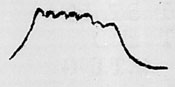
(c) Pulse width - 9 Micro seconds How measured - SPA
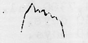
(d) Sketch pulse
(e) Lobe switching was not used.
(f) Polarization of enemy signal - none.
(g) Sweep rate - irregular - probably hand train
6. Radar was probably used for surface search.
7. Action of enemy radar, including distances and bearings at which he searched, tracked, faded, etc. - With full gain on APR and SPA, obtained about 2/3 saturation signal at 18 miles.
B.
1. Ship or station - U.S.S. DRUM (SS-228)
2. Area covered on this mission - Nansei Shoto Islands, 19 Dec. to 13 Jan. 1945
3. Enemy radar was landbased.
(a) Enemy installation was not seen. Definitely located on Takara Jima, Lat. 29-09 N., Long. 129-13 E.
4. Intercept equipment - APR - SPA
5.
(a) Frequency 155 Mc. Dial readings APR
(b) PRF 600 How measured - SPA
(c) Pulse width - 8 Micro seconds How measured SPA
(d) Sketch pulse
(e) Lobe switching was not used.
(f) Polarization of enemy signal - none.
(g) Sweep rate - erratic
6.
(a) Radar was used for surface search.
7. Action of enemy radar, including distances and bearings at which he searched, tracked, faded, etc. - With full gain on APR and SPA obtained 3/4 saturation signal at 24 miles; at 8-10 miles obtained saturation signal at about 3/4 gain settings.
C.
1. Ship or station - U.S.S. DRUM (SS-228)
2. Area covered on this mission - Nansei Shoto Islands, 19 Dec. to 13 Jan. 1945
3. Enemy radar was landbased.
(a) Enemy installation was not seen, possibly located on Kikai Jima
4. Intercept equipment - APR - SPA
5.
(a) Frequency 81-82 Mc. Dial readings APR
(b) PRF 300 How measured - SPA
(c) Pulse width - 20-25 Micro seconds How measured SPA meter
(d) Sketch pulse
(blank)
(e) Lobe switching was not used.
(f) Polarization of enemy signal - none.
(g) Sweep rate - erratic
6.
(a) Radar was used for air search.
(b) Evidence for this conclusion - characteristics of radar
Mark 18 Torpedo Information
Sixteen Mark 18-1 torpedoes were carried forward on this patrol.
No difficulty was experienced in handling or maintaining them. No watering was necessary. Only three hydrogen eliminator wires burned out. The average time between charges was eight days, average gravity drop was 18 points, and the average temperature was 78°F before and 87°F after charging.
| Previous Patrol | Back to top? | Next Patrol |