
| Date | Name of Vessel |
Type of Vessel |
Tonnage JANAC |
Tonnage Alden |
Location | Assessment JANAC |
Assessment Alden |
|---|---|---|---|---|---|---|---|
| 28 August 1943 | Yamagiri Maru | Passenger/Cargo | 6,438 | 6,438 | 1-30S, 148-35E | - | Damage Confirmed |
| 8 September 1943 | Hakutetsu Maru #13 | Cargo | 1,334 | 1,334 | 2-44S, 141-36E | Sunk | Sunk |
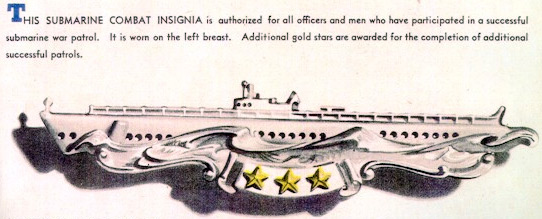
Award of Submarine Combat Insignia for this patrol is authorized.
(A) Prologue
(B) Narrative
(C) Weather
(D) Tidal Information
(E) Navigational Aids
(F) Ship Contacts
(G) Aircraft Contacts
(H) Attack Data
(I) Mines
(J) Anti Submarine Measures and Evasive Tactics
(K) Major Defects and Damage
(L) Radio
(M) Radar
(N) Sound Gear and Sound Conditions
(O) Density Layers
(P) Health, Food, and Habitability
(Q) Personnel
(R) Miles Steamed - Fuel Used
(S) Duration
(T) Factors of Endurance Remaining
(U) Remarks
Returned from sixth war patrol 26 July 1943. Normal refit by the Submarine Repair Unit, assisted by U.S.S. FULTON, at Brisbane, Australia. Port motor field interlock replaced. Wiped. Ready for sea: 16 August 1943.
| 16 August | |
| 925 (K) | Underway from alongside U.S.S. FULTON. |
| 1130-1330 | Conducted sound listening test in Moreton Bay, Australia. |
| 1450 | Fired 16 rounds of 4"/50 caliber and 120 rounds of 20 mm ammunition at a towed target. |
| 1645 | Anchored at examination point in Moreton Bay. |
| 1820 | Underway in company with HMAS GOULBURN, (J-167) and U.S.S. BOWFIN and U.S.S. TUNA. |
| 2135 | Made trim dive near point VAN. |
| 2230-2340 | Conducted night radar runs. |
| 1200 |
POSIT: LAT. 27-20.0 S. LONG. 153-14.0 E.
DIST: 30.0 FUEL: 146.0 |
| 17 August | |
| 0735-0840 (K) | Conducted submerged approach on HMAS GOULBURN. |
| 1237-1330 | Made successful dive to 320 feet. |
| 1915-1955 | Conducted night radar approach on HMAS GOULBURN. |
| 2350 | Left the training group and proceeded independently via point POND. |
| 1200 |
POSIT: LAT. 25-50.0 S. LONG. 154-50.0 E.
DIST: 212.7 FUEL: 1880 |
| 18 August | |
| Conducted three training dives, enroute point MILL. | |
| 1200 |
POSIT: LAT. 22-12.5 S. LONG. 154-31.0 E.
DIST: 288.1 FUEL: 2581 |
| 19 August | |
| 1900 (K) | Effected rendezvous with U.S.S. COUCAL in Lat. 15-20.0 S., Long. 153-15.0 E. |
| 1908 | Exchanged recognition signals with U.S.S. POMPON, on opposite course. |
| 1940-2150 | Conducted night radar runs on COUCAL, enroute Jomard Entrance. |
| 1200 |
POSIT: LAT. 17-10.0 S. LONG. 153-45.5 E.
DIST: 346.0 FUEL: 3479 |
| 20 August | |
| AM | Conducted two submerged approaches on COUCAL. |
| PM | Conducted two night radar runs on COUCAL. COUCAL reported that a DF report put a Japanese submarine inside Jomard Entrance. Sent a dispatch to CTF-72 concerning this report. |
| 1200 |
POSIT: LAT. 13-06.0 S. LONG. 152-36.0 E.
DIST: 294.3 FUEL: 2817 |
| 21 August | |
| 0635 (K) | Sighted land to westward of Jomard Entrance. COUCAL reported that she believed the DF report of yesterday in error. Received no conformation of it from CTF-72. Decided to carry out fueling as planned. |
| 0730 | Entered Jomard Entrance. |
| 0900 | Commenced fueling from COUCAL in Lat. 11-04.0 S., Long. 152-13.0 E. |
| 1100 | Received 13,264 gallons of fuel; filled with fresh water; topped off with stores and obtained several necessary items from COUCAL. |
| 1115 | Underway to the northward in company of COUCAL. |
| 1255 | Submerged to give COUCAL an hour of sound training. |
| 1445 | Surfaced and parted company with COUCAL. |
| 1454 | Submerged during daylight from now on. |
| 1933 | Surfaced. |
| 1200 |
POSIT: LAT. 10-57.0 S. LONG. 152-09.0 E.
DIST: 238.6 FUEL: 1888 |
| 22 August | |
| 0100 (K) | Set clocks to minus eleven (-11) zone time. |
| ALL TIMES HEREAFTER ARE "LOVE" | |
| 0545 | Submerged. |
| 1948 | Surfaced. |
| 1200 |
POSIT: LAT. 9-58.0 S. LONG. 153-11.0 E.
DIST: 101.2 FUEL: 552 |
| 23 August | |
| 0604 (L) | Submerged. |
| 1610 | Sighted a large two or four engined monoplane, distant 5 miles (Aircraft Contact No. 1) (Lat. 7-52.0 S., Long. 154-05.0 E.) |
| 1946 | Surfaced. |
| 1200 |
POSIT: LAT. 8-00.0 S. LONG. 154-05.0 E.
DIST: 183.8 FUEL: 2045 |
| 24 August | |
| 0325 (L) | Sighted Buka Island bearing 045°(T), distant 35 miles. |
| 0525 | Submerged. |
| 0800 | Sighted smoke bearing 005°(T), distant 10 miles. (Contact No. 1) (Lat. 5-07.5 S., Long. 154-11.0 E.). During the morning, this developed into a patrol boat, echo ranging on 18 kilocycles, patrolling on east-west courses, midway between Green Island and Cape Henpan. He never approached closer than about 7 miles. |
| 1145 | Lost contact with patrol boat. |
| 1947 | Surfaced. |
| 2350 | Sighted an aircraft flare in the vicinity of the Buka - New Ireland pass. This may have been from a "Black Cat". |
| 1200 |
POSIT: LAT. 5-00.0 S. LONG. 154-19.5 E.
DIST: 190.6 FUEL: 1988 |
| 25 August | |
| 0552 (L) | Submerged. |
| 1950 |
Surfaced. During the evening, we passed about five miles north of Malum Islands, having been set southward, but did not sight them. |
| 1200 |
POSIT: LAT. 3-08.0 S. LONG. 155-03.0 E.
DIST: 179.6 FUEL: 1534 |
| 26 August | |
| 0558 (L) |
Submerged. Found a leaky blow valve in the air flask of the torpedo in #5 tube. Recharged it, and decided that we may unload it through the muzzle tomorrow. If we don't shoot, we shall have to replace it with a tight torpedo the following day. |
| 2020 | Surfaced. |
| 1200 |
POSIT: LAT. 2-25.0 S. LONG. 152-30.0 E.
DIST: 175.6 FUEL: 1468 |
| 27 August | |
| 0545 (L) | Submerged between New Hanover and Mussau Islands. The sea is glassy, the visibility excellent. |
| 0845 | Sighted two float biplanes ("Daves") headed for Kavieng. (Aircraft Contact No. 2) (Lat. 2-02.0 S., Long. 149-54.0 E.) |
| 1000 | Sighted another "Dave" also headed toward Kavieng. (Aircraft Contact No. 3) (Lat. 2-01.0 S., Long. 149-50.0 E.) |
| 1045 | Sighted smoke bearing 163°(T) distant 30,000 yards (Contact No. 2) (Lat. 2-01.0 S., Long. 149-48.0 E.) This contact later developed into a two ship convoy with a single escort echo-ranging on 18 kilocycles. One steamer was an MFM type, the other an MMF, both small, and smoking heavily. When first sighted these ships appeared to be on an easterly course and consequently passing well clear. No attempt was made to close them. |
| 1120 | Sighted still another "Dave" headed for Kavieng (Aircraft Contact No. 4) (Lat. 2-00.0 S., Long. 149-46.0 E.) |
| 1135 | Sighted a type Zero float plane ("Rufe") in a glide toward us. Went deep to avoid detection, but no bombs fell. (Aircraft Contact No. 5) (Lat. 2-00.0 S., Long. 149-45.0 E.) |
| 1225 | Upon returning to periscope depth, discovered that the convoy was on a northerly course going from Tingwon to the eastward of Mussau. It was now too late to close them. The great range at which the smoke was sighted had led us to believe they were not closing us. Their speed was about 8 knots. |
| 1545 | Sighted smoke bearing 160°(T), distant 50,000 yards (Contact No. 3) (Lat. 1-49.0 S., Long. 149-37.0 E.) Commenced tracking and estimated the course to be 310°(T), speed 7 knots. Determined the convoy to contain at least four ships with two escorts pinging on 18 kilocycles. Could not close them for a daylight attack. |
| 2019 | Surfaced, and commenced closing the convoy. |
| 2230 | Made radar contact at 17,550 yards. Commenced the approach. |
| 1200 |
POSIT: LAT. 1-56.0 S. LONG. 149-43.0 E.
DIST: 166.6 FUEL: 1395 |
| 28 August | |
| 0030 (L) | Manned battle stations (Attack No. 1) (Lat. 1-30.0 S., Long. 148-35.0 E.) |
| 0054-15" | The after escort, broad on the starboard bow, range 3000 yards, turned on a small searchlight. |
| 0054-30" | Fired #3 tube. |
| 0054-37" | Fired #4 tube. |
| 0054-44" | Fired #5 tube. |
| 0054-51" | Fired #6 tube. |
| 0055 | Submerged, with the escort about 2500 yards away, still showing his light. Shifted targets to the next ship in the convoy. (Attack No. 1A) (Lat. 1-30.0 S., Long. 148-35.0 E.) |
| 0055-10" | Fired #2 tube. |
| 0055-20" | Fired #1 tube. |
| 0056-41" | Heard #4 torpedo hit. |
| 0056-50" | Heard #5 torpedo hit. |
| 0057 | First of three depth charges, close, knocking small bits of cork loose, as we pass 230 feet. |
| 0058-30" | Heard #2 torpedo hit. |
| 0100 | Five depth charges, close, but overhead. Two vessels echo-ranging, and staying right with us, as we evade on southerly to southwesterly courses. |
| 0111 | Three depth charges, close. |
| 0113 | One more. |
| 0142 | Three more, farther away. |
| 0208 | Seven this time, still farther. |
| 0226 | Five in the last barrage, distant. A total of twenty seven charges were dropped, but they caused no damage. |
| 0515 | Surfaced and cleared the area to the westward. There was no opportunity to regain contact for further attacks. |
| 0606 | Submerged. |
| 2020 | Surfaced. |
| 1200 |
POSIT: LAT. 1-43.0 S. LONG. 147-58.0 E.
DIST: 116.5 FUEL: 843 |
| 29 August | |
| 0616 (L) | Submerged. |
| 0858 | Sighted smoke bearing 283°(T), distant 20,000 yards. (Contact No. 4) (Lat. 1-32.0 S., Long. 146-02.0 E.). Commenced the approach. |
| 0922 | Manned battle stations submerged. (Attack No. 2) (Lat. 1-32.0 S., Long. 145-59.0 E.) |
| 0959-47" | Fired #1 tube. |
| 0959-55" | Fired #2 tube. |
| 1000-02" |
Fired #5 tube. All missed. |
| 1006-42" | One "end of run" explosion, which jarred the boat considerably. |
| 2024 | Surfaced. |
| 1200 |
POSIT: LAT. 1-31.5 S. LONG. 145-55.5 E.
DIST: 124.9 FUEL: 890 |
| 30 August | |
| 0647 (L) | Submerged. |
| 2030 | Surfaced. |
| 1200 |
POSIT: LAT. 2-24.0 S. LONG. 144-07.5 E.
DIST. 127.7 FUEL: 782 |
| 31 August | |
| 0620 (L) | Submerged fifteen miles off the coast of New Guinea in Long. 143° E. |
| 0800 | Sighted the masts of a small coastal steamer close inshore, out of reach. (Contact No. 5) (Lat. 3-07.0 S., Long. 143-05.0 E.). |
| 1400 | Sighted a small MMF steamer with a deck cargo, similar to Hoko Maru, 1514 tons. (Contact No. 6) (Lat. 2-59.0 S., Long. 143-00.0 E.). The minimum range was 8000 yards. |
| 2025 | Surfaced. |
| 1200 |
POSIT: LAT. 3-00.0 S. LONG. 143-04.0 E.
DIST: 95.7 FUEL: 325 |
| 1 September | |
| 0624 (L) |
Submerged. Patrolled in the vicinity of 3° S., 143° E. The peaks and other landmarks are extremely difficult to identify, Kairiru Island is the only reliable point in this locality. |
| 2030 | Surfaced. |
| 1200 |
POSIT: LAT. 3-00.0 S. LONG. 142-57.0 E.
DIST: 95.6 FUEL: 319 |
| 2 September | |
| 0631 (L) | Submerged. |
| 2037 |
Surfaced. Sighted searchlights during the evening in the vicinity of But and Dagua; and a bright glow in the sky near Wewak. |
| 1200 |
POSIT: LAT. 2-57.0 S. LONG. 143-21.0 E.
DIST: 92.5 FUEL: 320 |
| 3 September | |
| 0430 (L) | More searchlights along the New Guinea coast. |
| 0625 | Submerged. |
| 2030 |
Surfaced. Decided to shift operations to a point between Hollandia and Aitape, and close the coast there. |
| 1200 |
POSIT: LAT. 3-01.0 S. LONG. 143-01.0 E.
DIST: 87.4 FUEL: 344 |
| 4 September | |
| 0630 (L) |
Submerged. Closed to about four miles from the coast and patrolled parallel to it. |
| 2030 | Surfaced. |
| 1200 |
POSIT: LAT. 2-52.0 S. LONG. 141-47.0 E.
DIST: 91.7 FUEL: 320 |
| 5 September | |
| 0627 (L) |
Submerged. Again closed the coast to about four miles. Saw the smoke of two or three fires in the jungle, but no other evidence of civilization. |
| 2032 | Surfaced. |
| 1200 |
POSIT: LAT. 2-50.0 S. LONG. 141-55.0 E.
DIST: 90.0 FUEL: 376 |
| 6 September | |
| 0630 (L) |
Submerged. Closed to about two miles, slightly to the westward of our position of the last two days. Saw a few huts in a small clearing near the beach. |
| 2037 | Surfaced. |
| 1200 |
POSIT: LAT. 2-51.0 S. LONG. 142-00.0 E.
DIST: 89.5 FUEL: 315 |
| 7 September | |
| 0628 (L) |
Submerged. Closed to about three miles from the coast. |
| 1202 | Sighted one heavy bomber ("Sally"), headed to seaward from Hollandia. (Aircraft Contact No. 6) (Lat. 2-53.0 S., Long. 141-57.0 E.). During the afternoon, we saw about fifty or more huts, just off the beach between Long. 141-36.0 E. and 141-40.0 E. A few fires were visible, but no other signs of life could be seen. |
| 2032 | Surfaced. |
| 1200 |
POSIT: LAT. 2-53.0 S. LONG. 141-57.0 E.
DIST: 97.0 FUEL: 365 |
| 8 September | |
| 0629 (L) | Submerged. |
| 1158 | Sighted smoke bearing 288°(T), distant 16,000 yards. (Contact No. 7) (Lat. 2-44.0 S., Long. 141-37.0 E.) Commenced the approach. |
| 1244 | Manned battle stations submerged. (Attack No. 3) (Lat. 2-44.0 S., Long. 141-36.0 E.) |
| 1336-02" | Fired #7 tube. |
| 1336-10" | Fired #8 tube. |
| 1336-18" | Fired #9 tube. |
| 1337-02" | #8 torpedo hit about fifty feet abaft the MOT. |
| 1338-35" | Ship sank, leaving about 100 survivors in lifeboats, on rafts, and in the water. Commenced closing the area to survey the survivors. There were far more men aboard than are necessary to man a 300 tonner. |
| 1407 | Sighted a small freighter bearing 105°(T), headed westward, distant 10,000 yards. (Contact No. 8) (Lat. 2-45.0 S., Long. 141-38.0 E.). Commenced the approach. The freighter was a 1500-2000 ton MFM, well deck type, zig-zagging from 250°(T) to 290°(T) in four minute legs; and towing several small sampans. |
| 1432 | When the range was 800 yards, angle on the bow 25° starboard, the target zigged at the periscope, bombs commenced falling, and we went to 150 feet. (Aircraft Contact No. 7) (Lat. 2-45.0 S., Long. 141-40.0 E.) |
| 1437 | Returned to periscope depth and saw the freighter heading for the beach, range 3500 yards. It was obvious that he had known a submarine was present when he sighted the wreckage from our first attack; that he had sighted us; and that he would not give us a further favorable attack opportunity. He cruised parallel to the beach, close in, for the next hour and showed no inclination toward coming out to rescue the remaining survivors, some of whom were still in the water. |
| 1600 | Decided against expending any torpedoes on him and cleared the area. |
| 1600 | The Commanding Officer saw an irate member of the torpedoed ship's company kick one of his shipmates over the side of a lifeboat. |
| 1615 | Heard numerous small explosions, either gunfire or light aircraft bombs. |
| 1800 | All hands partook of an eight layer monster birthday cake which the galley baked for Lytle, G.W., C/1c. |
| 2032 | Surfaced. |
| 1200 |
POSIT: LAT. 2-44.0 S. LONG. 141-37.0 E.
DIST: 96.2 FUEL: 344 |
| 9 September | |
| 0643 (L) | Submerged. |
| 2032 | Surfaced. |
| 1200 |
POSIT: LAT. 2-00.0 S. LONG. 141-50.0 E.
DIST: 108.9 FUEL: 537 |
| 10 September | |
| 0630 (L) | Submerged. |
| 2032 |
Surfaced. The SJ radar obtained pips within 1000 yards several times, but nothing was seen except partly submerged tree trunks, upwards of one foot in diameter and thirty feet in length. |
| 1200 |
POSIT: LAT. 1-50.0 S. LONG. 142-01.0 E.
DIST: 98.2 FUEL: 355 |
| 11 September | |
| 0630 (L) | Submerged. |
| 2032 | Surfaced. |
| 1200 |
POSIT: LAT. 1-38.0 S. LONG. 141-52.0 E.
DIST: 99.8 FUEL: 336 |
| 12 September | |
| 0630 (L) | Submerged. |
| 2032 | Surfaced. |
| 1200 |
POSIT: LAT. 1-45.5 S. LONG. 141-59.0 E.
DIST: 94.1 FUEL: 322 |
| 13 September | |
| 0630 (L) | Submerged. |
| 2036 | Surfaced. |
| 1200 |
POSIT: LAT. 2-04.5 S. LONG. 142-11.0 E.
DIST: 87.6 FUEL: 357 |
| 14 September | |
| 0630 (L) | Submerged. |
| 2034 | Surfaced. |
| 1200 |
POSIT: LAT. 1-32.0 S. LONG. 141-52.0 E.
DIST: 92.3 FUEL: 328 |
| 15 September | |
| 0630 (L) | Submerged. |
| 2034 | Surfaced. |
| 1200 |
POSIT: LAT. 1-39.0 S. LONG. 141-53.5 E.
DIST: 93.5 FUEL: 321 |
| 16 September | |
| 0630 (L) | Submerged. |
| 2034 | Surfaced. |
| 1200 |
POSIT: LAT. 1-28.0 S. LONG. 141-31.0 E.
DIST: 93.1 FUEL: 379 |
| 17 September | |
| 0625 (L) | Submerged. |
| 2035 | Surfaced. |
| 1200 |
POSIT: LAT. 2-05.0 S. LONG. 142-10.0 E.
DIST: 103.5 FUEL: 445 |
| 18 September | |
| 0625 (L) | Submerged. |
| 2033 | Surfaced. |
| 1200 |
POSIT: LAT. 2-08.0 S. LONG. 144-00.0 E.
DIST: 118.7 FUEL: 814 |
| 19 September | |
| 0613 (L) | Submerged. |
| 2020 | Surfaced. |
| 1200 |
POSIT: LAT. 2-00.0 S. LONG. 145-17.0 E.
DIST: 98.7 FUEL: 337 |
| 20 September | |
| 0613 (L) | Submerged. |
| 2021 | Surfaced. |
| 1200 |
POSIT: LAT. 2-04.0 S. LONG. 145-10.0 E.
DIST: 95.6 FUEL: 371 |
| 21 September | |
| 0623 (L) | Submerged. |
| 2031 | Surfaced. |
| 1200 |
POSIT: LAT. 2-05.0 S. LONG. 143-44.0 E.
DIST: 122.2 FUEL: 755 |
| 22 September | |
| 0622 (L) | Submerged. |
| 2030 | Surfaced. |
| 1200 |
POSIT: LAT. 2-21.5 S. LONG. 144-33.0 E.
DIST: 119.4 FUEL: 716 |
| 23 September | |
| 0100 (L) | Received orders to terminate patrol. |
| 0300 | Passed Hermit Islands abeam to port, distant 13 miles. No enemy activity observed. |
| 0615 | Submerged. |
| 2015 | Surfaced. |
| 1200 |
POSIT: LAT. 1-19.0 S. LONG. 146-13.0 E.
DIST: 142.2 FUEL: 1189 |
| 24 September | |
| 0558 (L) | Submerged. |
| 2003 | Surfaced. |
| 1200 |
POSIT: LAT. 00-17.0 S. LONG. 149-09.0 E.
DIST: 175.5 FUEL: 1941 |
| 25 September | |
| 0545 (L) | Submerged. |
| 1945 | Surfaced. |
| 1200 |
POSIT: LAT. 00-18.0 S. LONG. 152-06.0 E.
DIST: 182.5 FUEL: 2455 |
| 26 September | |
| 0552 (L) | Submerged. |
| 1924 | Surfaced. |
| 1200 |
POSIT: LAT. 1-53.0 S. LONG. 154-48.0 E.
DIST: 192.0 FUEL: 2477 |
| 27 September | |
| 0541 (L) | Submerged. |
| 1921 | Surfaced. |
| 1200 |
POSIT: LAT. 4-37.0 S. LONG. 156-01.0 E.
DIST: 183.5 FUEL: 2642 |
| 28 September | |
| 0553 (L) | Submerged. |
| 0730 | Sighted a large monoplane on a northerly course, distant 8 miles. (Aircraft Contact No. 8) (Lat. 6-30.0 S., Long. 158-25.0 E.) |
| 1512 | Surfaced. |
| 1536 | Sighted a submarine bearing 327°(T), distant 8 miles in Lat. 6-41.0 S., Long. 158-47.0 E. |
| 1540 | Submerged to establish identity of submarine, since we expected to meet U.S.S. GATO today. |
| 1600 | Surfaced, identity established, and recognition signals fired. Proceeded in company with GATO to rendezvous. |
| 1200 |
POSIT: LAT. 6-35.0 S. LONG. 158-36.0 E.
DIST: 198.5 FUEL: 2662 |
| 29 September | |
| 0255 (L) | Sighted Ramos Island distant 35 miles. |
| 0515 | Exchanged recognition signals with escort, U.S.S. STRINGHAM (APD 6), and proceeded to Tulagi Harbor. |
| AM | Sighted numerous friendly surface craft and aircraft. |
| 1025 | Moored to Yog 41 in Tulagi Harbor. |
| 1100 | Commenced defueling. |
| 1200 | GUARDFISH came alongside for fuel. Since the barge could not receive and give fuel at the same time, defueling secured until GUARDFISH is fueled. Gave GUARDFISH our excess fresh meat. |
| 2145 | Defueling completed transferred 36,156 gallons of diesel oil to Yog 41. |
| 1200 |
POSIT: Tulagi Harbor, Solomon Islands
DIST: 247.7 FUEL: 2746 |
| 30 September | |
| Received orders to give U.S.S. GATO our gyro south rotor, and await spare from Brisbane. | |
| 1323 (L) | GATO underway with our gyro rotor. |
| 1200 |
POSIT: Tulagi Harbor, Solomon Islands
DIST: 00.0 FUEL: 0 |
| 1 October | |
| 2200 (L) | Spare rotor received, and gyro in commission. |
| 1200 |
POSIT: Tulagi Harbor, Solomon Islands
DIST: 00.0 FUEL: 254 |
| 2 October | |
| 0855 (L) | Underway in company with HMNZS MATAI. |
| 1500 | Submerged to give MATAI sound training. |
| 1635 | Surfaced, and proceeded independently. |
| 1200 |
POSIT: LAT. 9-12.0 S. LONG. 159-35.5 E.
DIST: 35.0 FUEL: 268 |
| 3 October | |
| 1200 |
POSIT: LAT. 13-09.5 S. LONG. 157-35.0 E.
DIST: 314.6 FUEL: 3680 |
| 4 October | |
| 1200 |
POSIT: LAT. 18-20.0 S. LONG. 157-06.0 E.
DIST: 332.2 FUEL: 4642 |
| 5 October | |
| 1200 |
POSIT: LAT. 23-18.0 S. LONG. 154-33.0 E.
DIST: 348.0 FUEL: 4470 |
| 6 October | |
| 0250 (L) | Sighted Caloundra Light bearing 270°(T), distant 35 miles. |
| 0325 | Sighted Cape Moreton Light bearing 250°(T), distant 20 miles. |
| 0410 | Sighted a ship in the vicinity of point VAN. He refused to answer challenge. Sent a dispatch to CTF-72 concerning this ship, which was not a submarine. |
| 0600 | Identified ship as a friendly merchantman. Obviously he had no reply to our challenge. |
| 0930 | Entered Brisbane River. |
| 1030 |
Moored to U.S.S. FULTON.
DIST: 307.5 FUEL: 4820 |
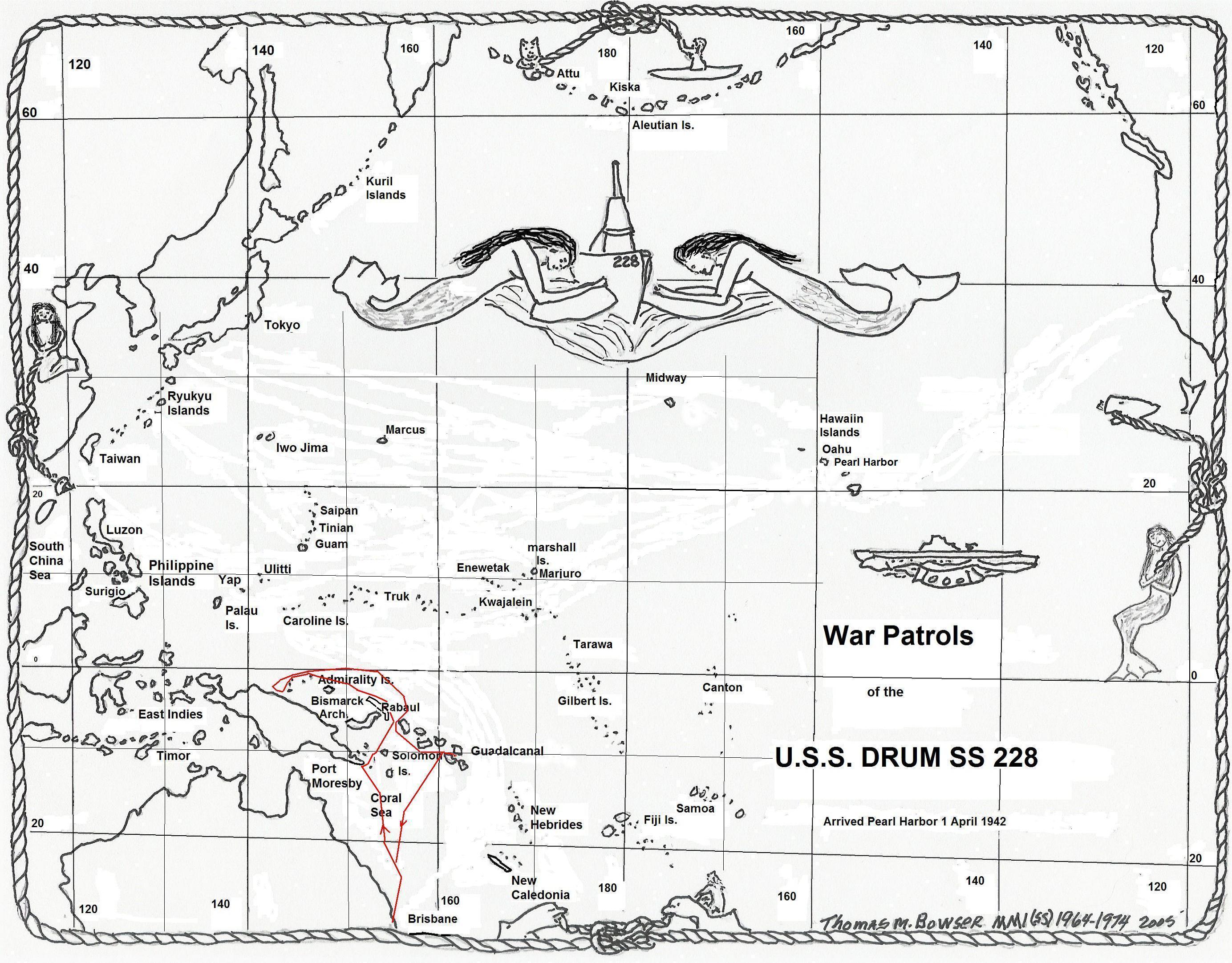
The area between the north coast of New Guinea and the Admiralty Islands was far more favorable for submerged operations than the areas nearer the equator. The average winds were force two, predominantly southeast to southwest. On five days the seas were calm and glassy; but during the remainder, sea conditions up to three were experienced.
Nearly every night extremely heavy lightning along the New Guinea coast was seen, which at times assumed the appearance of gunfire.
Variable currents up to one knot, setting southeast to southwest were noted well off the coast of New Guinea, south of the Admiralty Islands. A westerly set of one knot, close to the coast between Aitape and Hollandia, was encountered on four successive days.
None sighted.
No uncharted shoals were discovered anywhere between the north coast of New Guinea and the Admiralty Islands, between longitudes 147° E. and 140° E.
| No. | Date | Time | Lat. South |
Long. East |
Description | Init. Range | Min. Range | Course | Speed RPM |
Contact By | Remarks |
|---|---|---|---|---|---|---|---|---|---|---|---|
| 1. | 27 Aug. | 0800 (L) | 5-07.5 | 154-11 | Patrol Boat | 20,000 yds. | 14,000 yds. | 090° 270° |
- | P | Ping. on 18 Kcs. |
| 2. | 27 Aug. | 1045 (L) | 2-01.0 | 149-48 | 2 Freighters 1 Escort |
30,000 yds. | 16,000 yds. | 015° | 8 knots | P | Pass. east Mussau Is. |
| 3. | 27 Aug. | 1545 (L) | 1-49.0 | 149-37 | 5 Med. Freighters 2 Escorts |
50,000 yds. | 3000 yds. | 310° | 10 knots | P | Attacks No. 1 & 1A |
| 4. | 29 Aug. | 0858 (L) | 1-24.0 | 146-04 | 2000 ton Freighter | 20,000 yds. | 2000 yds. | 110° | 12 knots 115 RPM |
P | Attack No. 2 |
| 5. | 31 Aug. | 0800 (L) | 3-07.0 | 143-05 | Coastal Steamer | 16,000 yds. | 16,000 yds. | 090° | - | P | |
| 6. | 31 Aug. | 1400 (L) | 3-00.0 | 143-04 | 1500 ton Freighter | 14,000 yds. | 8000 yds. | 120° | - | P | Deck cargo to Wewak |
| 7. | 8 Sept. | 1158 (L) | 2-44.0 | 141-37 | 3000 ton Freighter | 16,000 yds. | 1300 yds. | 108° | 8.5 knots 75 RPM |
P | Attack No. 3 |
| 8. | 8 Sept. | 1405 (L) | 2-44.0 | 141-36 | 1500 ton Freighter | 10,000 yds. | 500 yds. | 290° | 9 knots | P | Zigged at periscope. |
| No. | Date | Time | Lat. South |
Long. East |
Description | Range | Course | Altitude | Contact By | Remarks |
|---|---|---|---|---|---|---|---|---|---|---|
| 1. | 23 Aug. | 1610 (L) | 7-52 | 154-05 | Multi Eng. Monoplane | 10,000 yds. | 315° | Low | P | - |
| 2. | 27 Aug. | 0845 (L) | 2-02 | 149-54 | 2 Daves | 24,000 yds. | 125° | 3000 ft. | P | Headed for Kavieng |
| 3. | 27 Aug. | 1000 (L) | 2-01 | 149-50 | 1 Dave | 10,000 yds. | 140° | Low | P | Headed for Kavieng |
| 4. | 27 Aug. | 1120 (L) | 2-00 | 149-46 | 1 Dave | 10,000 yds. | 120° | Low | P | Headed for Kavieng |
| 5. | 27 Aug. | 1135 (L) | 2-00 | 149-45 | 1 Rufe | 4000 yds. | - | 500 ft. | P | Glided at Peris. No bombs dropped. |
| 6. | 7 Sept. | 1202 (L) | 2-53 | 141-57 | 1 Sally | 10,000 yds. | 315° | 5000 ft. | P | - |
| 7. | 8 Sept. | 1432 (L) | 2-45 | 141-40 | Unident. | - | - | - | Not Sight. | Dropped several bombs. |
| 8. | 28 Sept. | 0730 (L) | 6-30 | 158-25 | Large Monoplane | 16,000 yds. | 335° | Low | P | Presumably friendly. |
U.S.S. DRUM, Torpedo Attack No. 1 & 1A, Patrol No. 7
Time: 0054 (L) Date: 28 August 1943 Lat. 1-30 S., Long. 148-35 E.
Target Data - Damage Inflicted
Description:
Sighted smoke of four ships at 1545 (L), 27 August 1943; heard echo ranging on 18 kilocycles at 1850 (L); tracked submerged, and estimated the convoy's course 310°(T), speed 7 knots until dark. Surfaced, and closed, stopping every half hour to obtain bearings on the pinging, which continued throughout the engagement. Made radar contact at 2230 (L) at 17,550 yards, and determined convoy to consist of five medium freighters and two escorts. They were traveling with three freighters in line, with one ahead and one astern. One escort led the formation; while the other brought up the rear.
The visibility was good, with a glassy sea, bright starlight, and few horizon clouds. The merchantmen were sighted at 20,000 yards.
Ships Sunk:
None.
Ships Damaged:
(1) One medium sized freighter damaged and probably sunk.
(2) One medium sized freighter damaged.
Damage Determined By:
(1) Hearing two torpedo hits in first ship.
(2) Hearing one torpedo hit in the second ship.
(3) Hearing the "ship breaking up" noises from the vicinity of the attack.
Target Draft 16 feet, Course 310°, Speed 10 knots, Range #1 3200 yds. #1A 4400 yds.
Own Ship Data:
#1 Speed 15 knots, Course 030° to 035°, Depth surface, Angle 0°
#1A Speed 10 knots, Course 058° and 076°, Depth 30 feet, Angle 5°D
Type Attack
Tracked the convoy by radar, using a plot and the TDC. Determined the course as 310°(T), speed 10 knots. The convoy was not zig-zagging. Gained an attack position on the port beam of the leftmost ship, and took a course for a 100° port track at 15 knots, presenting less than a 10° angle on the bow to the target at all times.
Attack #1:
Fired four torpedoes, using radar ranges and bearings, at 3200 yards, torpedo run 3200 yards. Spread of 2°L, 1/2°L, 1/2°R, 2°R using offset dial, gave gyro angles from 2°R to 2°L, as the ship was swinging slowly to the right. Results: Two hits 2 min. 4 sec. and 2 min. 6 sec. after firing the second and third torpedoes.
Attack #1A:
Fired two more torpedoes, while swinging hard right and diving to avoid the escort bearing down from starboard, at a second ship beyond the first. Range by radar 4400 yards, torpedo run 4400 yards. Spread of 1/2°L, 0° using the offset dial, gave gyro angles of 26°L and 47°L. Results: One hit 3 min. 15 sec. after firing the first torpedo of this salvo.
| Attack #1 | ||||||
|---|---|---|---|---|---|---|
| Tubes Fired | #3 | #4 | #5 | #6 | #2 | #1 |
| Track Angle | 98°P | 98°P | 98°P | 98°P | 98°P | 102°P |
| Gyro Angle | 2°R | 1°R | 1°L | 2°L | 26°L | 47°L |
| Depth Set | 12 ft. | 12 ft. | 12 ft. | 12 ft. | 12 ft. | 12 ft. |
| Power | High | High | High | High | High | High |
| Hit or Miss | Miss | Hit | Hit | Miss | Hit | Miss |
| Erratic? | No | No | No | No | No | No |
| Mark Torpedo | 14-3A | 14-3A | 14-3A | 14-3A | 14-3A | 14-3A |
| Serial No. | 19240 | 22566 | 23377 | 25027 | 20238 | 24789 |
| Mark Exploder | VI-1 | VI-1 | VI-1 | VI-1 | VI-1 | VI-1 |
| Serial No. | 18017 | 6265 | 5186 | 5674 | 6394 | 6439 |
| Actuation Set | Contact Magnetic |
Contact Magnetic |
Contact Magnetic |
Contact Magnetic |
Contact Magnetic |
Contact Magnetic |
| Actuation Actual | - | Contact | Contact | - | Contact | - |
| Mark Warhead | XVI | XVI | XVI | XVI | XVI | XVI |
| Serial No. | 907 | 10194 | 894 | 892 | 9945 | 9931 |
| Explosive | TPX | TPX | TPX | TPX | TPX | TPX |
| Firing Interval | - | 7 sec. | 7 sec. | 7 sec. | - | 10 sec. |
| Type Spread | 2°L | 1/2°L | 1/2°R | 2°R | 1/2°L | 0 |
| DIVERGENT | DIVERGENT | |||||
Sea conditions - flat, glassy, calm.
Overhaul activity - U.S.S. FULTON.
U.S.S. DRUM, Torpedo Attack No. 2, Patrol No. 7
Time: 1000 (L) Date: 29 August 1943 Lat. 1-32 S., Long. 145-59 E.
Target Data - Damage Inflicted
Description:
Single ship, unescorted, 2000 tons, MFM type.
Sighted smoke while submerged at 20,000 yards, in good visibility. Light wind, rippled surface.
Ships Sunk:
None.
Ships Damaged:
None.
Damage Determined By:
-
Target Draft 10 feet, Course 110°(T), Speed 12 knots, Range 2000 yds.
Own Ship Data:
Speed 2 knots, Course 170°, Depth 64 feet, Angle 0°
Type Attack
Normal submerged approach, using bow tubes. The distance to the track was excessive, but the firing bearing was reached before the track could be closed. A torpedo run of 2000 yards on a 124°P track had to be accepted. Several good echo ranges were obtained inside 3000 yards. The spread, using the offset dial, was 1°L, 0°, and 1°R, a total of 200 feet.
The three torpedoes were tracked by sound to and beyond the target. The Commanding Officer saw heavy smoke from one torpedo pass under the target's counter, but did not see the other two torpedoes. One end of run explosion, jarring the boat considerably, occurred 5 min. 55 sec. after firing the first torpedo.
| Attack #2 | |||
|---|---|---|---|
| Tubes Fired | #1 | #2 | #5 |
| Track Angle | 124°P | 124°P | 124°P |
| Gyro Angle | 4°L | 4°L | 4°L |
| Depth Set | 8 ft. | 8 ft. | 8 ft. |
| Power | High | High | High |
| Hit or Miss | Miss | Miss | Miss |
| Erratic? | No | Possibly | Possibly |
| Mark Torpedo | 14-3A | 14-3A | 14-3A |
| Serial No. | 23943 | 24037 | 24793 |
| Mark Exploder | VI-1 | VI-1 | VI-1 |
| Serial No. | 17641 | 10822 | 17648 |
| Actuation Set | Contact Magnetic |
Contact Magnetic |
Contact Magnetic |
| Actuation Actual | - | - | - |
| Mark Warhead | XVI | XVI | XVI |
| Serial No. | 4057 | 597 | 6375 |
| Explosive | TNT | TNT | TNT |
| Firing Interval | - | 8 sec. | 7 sec. |
| Type Spread | 1°L | 0 | 1°R |
| DIVERGENT | |||
Sea conditions - light ripple.
Overhaul activity - U.S.S. FULTON.
Remarks:
Though the TDC setup checked well prior to firing, the misses are attributed to low target speed set on the TDC.
U.S.S. DRUM, Torpedo Attack No. 3, Patrol No. 7
Time: 1336 (L) Date: 8 September 1943 Lat. 2-44 S., Long. 141-36 E.
Target Data - Damage Inflicted
Description:
Single ship, unescorted, 2900 tons, MFM type, split superstructure, well deck, similar to Senyo Maru.
Sighted smoke while submerged at 16,000 yards, in good visibility, light easterly wind, rippled surface.
Ships Sunk:
1 - 2900 tons
Ships Damaged:
None.
Damage Determined By:
Seeing one torpedo hit and watching the ship sink by the stern 93 seconds after the explosion. Two photographs were taken.
Target Draft 14 feet, Course 110°(T), Speed 8.5 knots, Range 1350 yds.
Own Ship Data:
Speed 2 knots, Course 030°(T), Depth 65 feet, Angle 0°
Type Attack
Normal submerged approach, tracking target with TDC, and obtaining echo ranges inside 3000 yards. Fired the stern tubes at a range of 1350 yards, using a spread of 2°L, 0°, 2°R introduced by the offset dial.
The second torpedo hit about fifty feet abaft the MOT, 52 seconds after firing. The third torpedo ran astern, but the first was not seen. Both the second and third torpedoes smoked heavily. There were no end of run explosions.
| Attack #3 | |||
|---|---|---|---|
| Tubes Fired | #7 | #8 | #9 |
| Track Angle | 79°P | 80°P | 81°P |
| Gyro Angle | 1°R | 0 | 1°L |
| Depth Set | 10 ft. | 10 ft. | 10 ft. |
| Power | High | High | High |
| Hit or Miss | Miss | Hit | Miss |
| Erratic? | No | No | No |
| Mark Torpedo | 14-3A | 14-3A | 14-3A |
| Serial No. | 32525 | 24757 | 24795 |
| Mark Exploder | VI-1 | VI-1 | VI-1 |
| Serial No. | 17651 | 5002 | 6262 |
| Actuation Set | Magnetic Contact |
Magnetic Contact |
Magnetic Contact |
| Actuation Actual | - | Contact | - |
| Mark Warhead | XVI | XVI | XVI |
| Serial No. | Not Known | 3651 | 883 |
| Explosive | TPX | TPX | TPX |
| Firing Interval | - | 8 sec. | 8 sec. |
| Type Spread | 2°L | 0 | 2°R |
| DIVERGENT | |||
Sea conditions - calm, light ripple.
Overhaul activity - U.S.S. FULTON.
No remarks.
The convoy of attacks no. 1 and no. 1A was formed with an escort leading, followed by a single maru, then three freighters in line, another single maru, and finally another escort. The two escorts echo ranged on 18 kilocyles from the time the convoy's smoke was sighted until contact was lost twelve hours later.
The pinging, during darkness, enabled us to maintain contact until the SJ radar picked the convoy up at 17,550 yards.
The trailing escort sighted us, turned toward, and showed a small searchlight about 15 seconds prior to firing, at a range of 3000 yards. No counter measures were employed prior to diving, however.
The depth charging, which followed the attack, was as prolonged as the Drum has undergone in several patrols, lasting one hour and thirty-five minutes, with a sound search lasting about three hours. At total of 27 charges were dropped.
During the first half hour of the counter attack, several effective runs were made. Echo ranging was used throughout the attacks, and no evidence of listening was noted. One escort used single pings, while the other employed double pings. Both used automatic keying, and never, even during an attack, was the interval less than 8 seconds.
The first depth charge exploded close aboard when the boat was at 230 feet, going down, and knocked small bits of cork loose. It is of interest to note that the Drum has never suffered any material damage, never had any appreciable cork dislodged, never had any lights broken, and never had any "sundry" loose items thrown clear of the bulkheads during seven patrols, and numerous depth charges.
The first eleven charges were in the "fairly close" category. The other sixteen were increasingly farther away.
Evasive tactics included silent running at 300 feet, using 80 RPM most of the time. The initial courses were about 50° to the left of the chosen retiring course. The retiring course was assumed as soon as the enemy began falling astern.
(1.) Engineering
During the last refit, an effort was made to synchronize the TBT's both electrically and mechanically. Two days out, both TBT's flooded out, and were useless the remainder of the patrol. A more accurate system of bearing transmission is desirable, though this ship has never relied on the TBT bearings during an attack. Renewal of the selsyn units has been requested, and may solve the problem.
After functioning well for the first month, the pitometer succumbed to a series of attacks and passed away on 17 September 1943. The final diagnosis is:
1. Rotary seal bellows contact surface non-corrosion resistant.
2. Control unit contact arm slips on shaft due to broken lower stop rod on bellows assembly.
3. Lack of all spares now shows up in all parts of the system.
A new control unit design has been submitted to the U.S.S. FULTON.
Twice main engine exhaust valves froze in the closed position after deep submergence and/or depth charge attack. This is due to the 75° angle seat, and can not be prevented.
Salt water was found in the starboard reduction gear sump for the third successive patrol. It is believed the water enters when the gear housing flange bolts are loosened by depth charging and vibration. Lock nuts are now installed, but a more positive means of preventing the housing from becoming loose is imperative.
#2 Vapor compression distiller again gave trouble, though its output was satisfactory. The compressor lobes were striking each other, and even after a complete overhaul, continued to do so. The gears are believed worn. A new compressor unit has been requested.
The U.S.S. FULTON finally solved the port 75% motor field interlock trouble, which has been with us for five patrols. A new interlock coil, frame, and plunger was installed during the last refit, and never was power lost on either shaft during this patrol.
No difficulties were experienced either in reception or transmission. All messages were sent to Australian stations.
There were no material casualties.
(1.) SJ
Not one minute of operating time was lost during the entire patrol. Land targets up to 45,000 yards, and ships up to 17,550 yards were detected. The magnetron installed has been operating perfectly for 1000 hours.
(2.) SD
Operation of the SD radar is uncertain. On 28 September, it failed to operate on surfacing. The cause was the failure of a resistor and a condenser in the cathode ray tube power circuit. The following day planes were detected at 16 miles, and land targets, 8000 feet high, at 60 miles. A thorough adjustment of the equipment has been requested.
(3.) ARC-1
Although the time on station was spent in close proximity to known enemy radar installations (Wewak and Hollandia), no indications of radar were obtained. The unit apparently operated satisfactorily, for shipboard noises were readily detected.
All sound gear cables piercing the pressure hull were renewed during the last refit. No material difficulties were experienced during this patrol.
Sound conditions were average in the area between the New Guinea coast and the Admiralty Islands. Screws of small steamers were heard at 6000 - 8000 yards. Many fish noises made conditions poor at times.
A definite thermocline was noted in Lat. 1-30 S., Long. 148-35 E. The temperature decreased 3° between 150 and 250 feet, and possibly another 3° to 320 feet. The gradient did not afford much protection during the early phases of the depth charge attack between 0100 (L) and 0230 (L) on 28 August 1943.
The crew suffered the usual minor ailments concomitant a shift from the cool climate of Brisbane to the tropics. One man was given oxygen through an escape lung to aid his breathing when he suffered from a severe chest cold.
The food was definitely superior to that obtained from the U.S.S. FULTON for the sixth patrol. The addition of fresh frozen fruits and vegetables was appreciated by all hands. The meat, especially the steak, was more tender, and definitely tastier. Coca-Cola, made with water, and set in the cold room to "ice up" was a delicious drink at any and all hours of the day.
One-third of a can of CO2 absorbent in each torpedo room on the all day dives made the boat comfortable throughout the run.
In spite of a turnover of one-third of the crew during the last two refit periods, the state of training, as well as the morale, is excellent.
This is due to a combination of two things. First, the caliber of the non-qualified personnel obtained from the Submarine Division 82 is high. Second, a vigorous training routine has been established prior to leaving on patrol; and continued during the entire run. Seventy percent of the personnel aboard are now qualified.
| Brisbane to Area | 2776.2 Miles | 24288 Gallons |
|---|---|---|
| In Area | 2390.4 Miles | 10590 Gallons |
| Area to Brisbane | 2530.0 Miles | 33057 Gallons |
| Total | 7696.6 Miles | 67935 Gallons |
| Days Enroute to Area | 14 |
|---|---|
| Days in Area | 24 |
| Days in Combat Zone | 34 |
| Days Enroute to Base | 13 |
| Days Submerged | 38 |
| Torpedoes | 12 |
|---|---|
| Fuel (36156 gals. transferred to Tulagi) | 17694 gallons |
| Provisions | 0 days |
| Personnel | 14 days |
The orders of Commander Task Force 72 to end the patrol.
The COUCAL was very cooperative. With her assistance several small casualties were repaired in a thorough manner in lieu of he chewing gum and bailing wire method in vogue while on patrol. The refueling was handled expeditiously; and 13,264 gallons of fuel, plus stores and fresh water, were received in two hours.
The shipping routes off New Guinea are very indefinite. I believe that small craft usually run close inshore, and that for this area, the best place to operate would be close inshore, above Hollandia, in the vicinity of Cape D'Urville.
The type voltage regulator installed on both the radio and IC motor generators is inadequate. The transmission of two messages was delayed until adjustment could be made to the regulator. The IC motor generators are run using "rheostat" control instead of regulator control. If no new design regulators are available complete reconditioning of the present ones is necessary.
| Previous Patrol | Back to top? | Next Patrol |